Hoi An World Cultural Heritage Conservation Center
Spatial and socio-economic organization of village communities in Hội An in the early 19th century through Nguyễn dynasty cadastral records
Within the territorial management system of the Vietnamese monarchic state, cadastral records (địa bạ) functioned as official documents used to establish administrative boundaries, define land ownership structures, and organize social life at the village level. Beyond serving fiscal and population management purposes, these records also comprehensively reflect the relationships between people and land, as well as between the state and local communities.
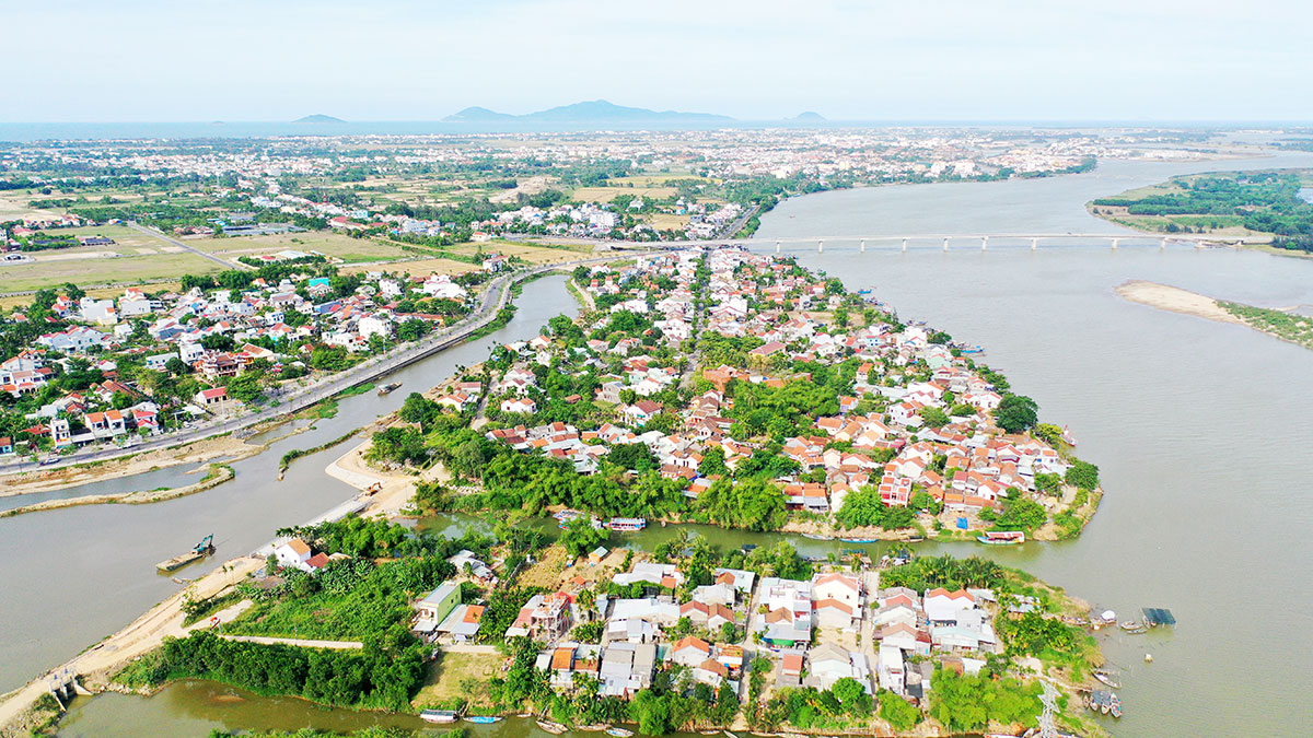
Panoramic view of Hoi An
In the case of Hội An, an urban trading port that developed on the foundation of village communities, the Nguyễn dynasty cadastral system compiled in the early 19th century holds particular significance. It not only documents the condition of landholdings but also enables a reconstruction of the spatial organization and the socio-economic structure of the broader urban–rural system associated with the port city of Hội An in history.
According to materials collected by the Hội An Center for Cultural Heritage Management and Preservation, there were 17 villages in Hội An for which cadastral records were established during the reign of Emperor Gia Long. These include: Đại An, Đông An, Hội An, Tân An, Kim Bồng, Phong Hộ, Minh Hương, An Mỹ, Hoa Phô, Để Võng, Tân Hiệp, Xuân Mỹ (recorded in the 13th year of Gia Long, 1814); Thanh Châu and Phước An (14th year, 1815); and Hòa An, Cẩm Phô, Thanh Hà (17th year, 1818). These cadastral registers provide detailed inventories of communal land, private farmland, residential land, burial grounds, land for temples, communal houses, and pagodas, as well as wasteland and other land categories, constituting a highly reliable source for studying village communities in Hội An.
Regarding the spatial organization of villages, within the Nguyễn dynasty’s administrative system, cadastral records functioned as tools for surveying, controlling, and structuring land at the local level. Each record carefully documented individual land plots, including information on location, size, land use type, and ownership. As a result, they offer a relatively complete picture of the economic and social conditions of each village community. For Hội An, where space integrated agriculture, handicrafts, and commerce, these records are particularly valuable, as they not only delineate land boundaries but also reveal social organization and occupational structures.
From these cadastral materials, three fundamental elements shaping the spatial character of Hội An’s villages can be identified:
First, the system of administrative boundaries between villages. These were established through physical markers such as wooden or stone posts, roads, field ridges, or natural features like rivers, mounds, and specific land zones. Each village’s four boundaries (east, west, south, north) were clearly recorded, defining not only its geographic position within Hội An but also its jurisdiction and land ownership rights.
Second, the structure of land distribution, including cultivated fields, residential land, communal land, burial land, and land designated for communal houses, temples, and pagodas. This structure reflects both economic capacity and spiritual and social organization. For example, in Hoa Phô village, the cadastral record specifies: “Communal land amounts to 61 mẫu 3 sào 14 thước 2 tấc (approximately 220,738 m², or 22.07 hectares). Private land amounts to 65 mẫu 2 sào 2 tấc 5 phân (approximately 234,725 m², or 23.47 hectares). Land designated for temples and pagodas totals 1 sào (approximately 360 m², or 0.036 hectares). Burial land amounts to 50 mẫu 6 sào 13 thước (approximately 182,952 m², or 18.30 hectares). Wasteland and sand dunes total 36 mẫu 6 sào 1 thước 5 tấc (approximately 131,076 m², or 13.11 hectares).”
Third, the forms of land ownership, where communal land, privately owned land, and land belonging to religious institutions coexisted. This reflects the interplay between collective interests, private property rights, and sacred spaces within the traditional Vietnamese village structure.
These records show that each village in Hội An was not merely an administrative unit but a complete socio-economic entity, with defined territory, distinct land structures, and an organizational model reflecting close relationships between habitation, production, and belief systems. This interconnectedness formed the foundation of the identity and resilience of Hội An’s village communities throughout the development of the port city.
Regarding functional differentiation among villages, one of the most notable values of Nguyễn dynasty cadastral records lies in their ability to reveal economic specialization among different communities within the same spatial system. Land ownership patterns varied significantly:
Some villages had both communal and private land, such as Cẩm Phô (56.16 ha communal, 39.96 ha private), Thanh Hà (68.4 ha communal, 108 ha private), Hoa Phô (21.96 ha communal, 23.4 ha private), and An Mỹ (7.2 ha communal, 13.68 ha private).
Some villages had only private land, such as Thanh Châu, Tân Hiệp, Để Võng, Tân An, Xuân Mỹ, and Kim Bồng (notably with 186.48 ha of mulberry fields).
Others had only communal land, such as Đại An (the largest with 163.08 ha), Đông An, Hòa An, Hội An, Phong Hộ, Minh Hương, and Phước An.
Beyond rice cultivation, cadastral records also document diverse land uses linked to specialized economic activities. In some villages, significant areas were devoted to crops such as mulberry, sugarcane, and nipa palm, for example: Kim Bồng (186.48 ha mulberry), Thanh Hà (12.6 ha mulberry, 9 ha sugarcane), Cẩm Phô (10.08 ha mulberry), An Mỹ (approximately 2.81 ha nipa palm).
In riverside, coastal, and island villages such as Để Võng and Tân Hiệp, fishing played a crucial economic role. This diversity indicates that Hội An’s economy was not solely rice-based but supported by multiple production sectors serving urban demand and trade.
These data demonstrate that Hội An functioned as a stratified spatial system, where different zones performed distinct but interconnected roles:
Areas along the Thu Bồn River and main transport routes had high densities of residential land and little or no agricultural land. These zones developed into urban spaces with streets, markets, warehouses, and wharves, including villages such as Hội An, Minh Hương, Cẩm Phô, and Hoa Phô. These were the centers of domestic and international trade. Minh Hương, inhabited by a Chinese-descended community, played a particularly important intermediary role, contributing to the city’s multicultural and international character.
Surrounding these were villages with dense populations and land associated with non-agricultural production, such as Kim Bồng and Thanh Hà. Kim Bồng was known for carpentry and shipbuilding, while Thanh Hà specialized in pottery and construction materials. Their land structures show concentrations of residential, religious, and burial land, reflecting dense craft communities supplying goods and services to the port city.
Further out were villages with large natural land areas and agricultural production, including Đại An, Đông An, Hòa An, Thanh Châu, An Mỹ, Phong Hộ, and Tân Hiệp. Located along rivers, coastlines, and islands, these villages produced rice, mulberry, sugarcane, and seafood, supplying the urban center.
This combination of residential, production, and commercial spaces formed an integrated operational structure, making Hội An a unified urban–rural system in historical terms.
From the Nguyễn dynasty cadastral records, it is clear that Hội An was not an isolated “town” separated from its rural hinterland, but rather a network of functionally differentiated yet closely interconnected village communities. Each village fulfilled a specific role within the system: commercial villages facilitated trade, craft villages supplied goods and services, and agricultural and fishing villages ensured food and raw materials. This systemic spatial–economic structure provided the durable foundation for the long-term prosperity of the Hội An trading port in history.
Author: Nguyễn Văn Thịnh
Source: Hoi An Center for the Conservation of World Cultural Heritage
Newer articles
Older articles